Valréas
R12 Les Blagiers
R12
Route
Loop
Difficulty
Intermediate
Duration
4h
Distance
10km
Positive elevation gain
227 meters
Negative elevation gain
227 meters
Altitude
Min. 243 meters
Max. 428 meters
Departure / Arrival
/
Parking
Parking Revoul, cours Saint-Antoine
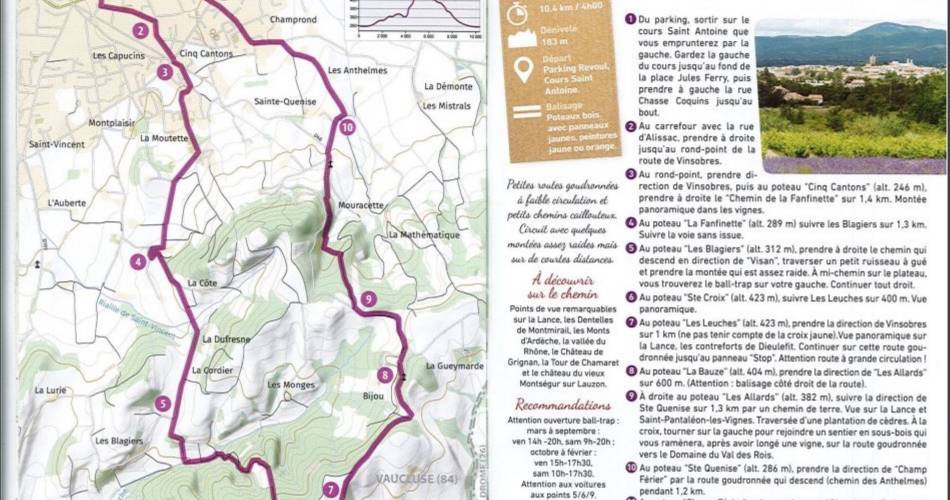
profil altimétrique
Traces GPX
1 / 3
Tourist service in Valréas :
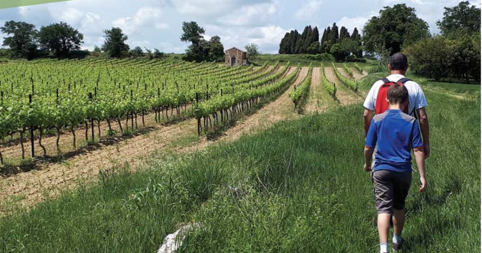
A walk combining countryside and historic heritage. Interpretation panels.Go to the route
public transportation
recommended parking
Parking Revoul, cours Saint-Antoine
To note
Watch out for the ball-trap opening.
Watch out for cars.
Watch out for cars.
 If you want to report a problem on your hike (marking, maintenance, danger...), let us know on Suricate: sentinels.sportsdenature.fr
Access to the massifs
Respect the regulations preserving protected natural areas – find out about restrictions to accessing the massifs during fire risk periods, from 15 June to 15 September.
Before heading out, check the website
Respect the regulations preserving protected natural areas – find out about restrictions to accessing the massifs during fire risk periods, from 15 June to 15 September.
Before heading out, check the website
In brief
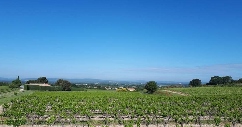
Remarkable views of the Lance, the Dentelles de Montmirail, the Monts d'Ardèche, the Rhône valley, the Château de Grignan, the Tour de Chamaret and the château of old Montségur sur Lauzon.Contact
Office de Tourisme Pays de Grignan - Enclave des PapesTel : View number
E-Mail : info@grignanvalreas-tourisme.com
Website : http://www.grignanvalreas-tourisme.com
Guided hikes
This page was produced with the help of theOffice de Tourisme Communautaire Pays de Grignan et Enclave des Papes