Monieux
MONIEUX - Les gorges de La Nesque
Route
Loop
Difficulty
Intermediate
Duration
3h
Distance
9km
Positive elevation gain
471 meters
Negative elevation gain
471 meters
Altitude
Min. 611 meters
Max. 866 meters
Departure / Arrival
Monieux - Place de la Liberté / Monieux - Place de la Liberté
Parking
profil altimétrique
1 / 2
Tourist service in Monieux :
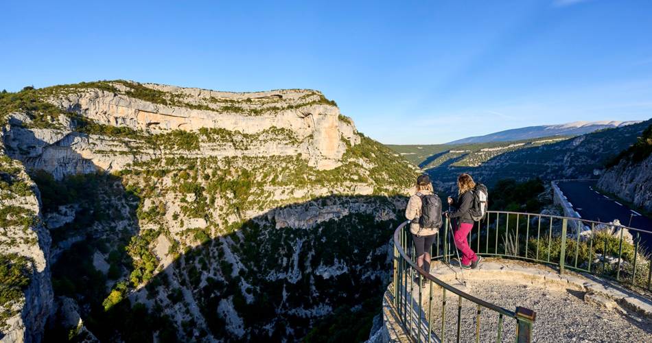
Partez à la découverte de ce canyon grandiose et sauvage ! Un des sites naturels les plus originaux et les plus sensibles de Provence.Go to the route
public transportation
Monieux is served by Bus 912 Carpentras-Sault of the Zou network. Operates on Saturdays - last bus from Monieux at 5pm. Allow 45 minutes by bus from Carpentras.
Stop at Notre Dame des Abeilles in Monieux.
You can also get to Carpentras by train.
Stop at Notre Dame des Abeilles in Monieux.
You can also get to Carpentras by train.
road access
Monieux, 6 km south-west of Sault via the D942.From Avignon, head towards Carpentras, then Villes-sur-Auzon, and Sault via the Gorges de la Nesque.Parking is available close to the departure point.Think about carpooling!
To note
Vertiginous passages, route not recommended to children or people highly susceptible to vertigo.
Not recommended in bad weather, as rain makes the rock slippery.
Many birds of prey nest in the high cliffs of the Gorges de la Nesque. Golden eagles, peregrine falcons, short-toed eagles, great horned owls and Egyptian vultures nest here and are easy to spot.
Rare and endangered species, please protect them by avoiding making noise or leaving the marked trails.
 If you want to report a problem on your hike (marking, maintenance, danger...), let us know on Suricate: sentinels.sportsdenature.fr
Access to the massifs
Respect the regulations preserving protected natural areas – find out about restrictions to accessing the massifs during fire risk periods, from 15 June to 15 September.
Before heading out, check the website
Respect the regulations preserving protected natural areas – find out about restrictions to accessing the massifs during fire risk periods, from 15 June to 15 September.
Before heading out, check the website
In brief
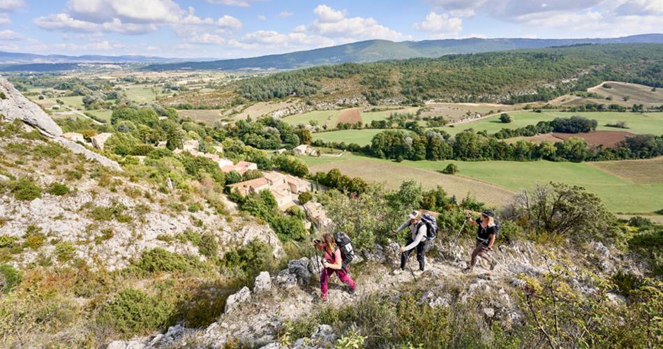
Discover the canyon, one of the most original and beautiful natural sites in Provence.A hike alternating between rocky ledges and slopes, paths along canyon bottoms, flower-filled meadows, scrubland and old forestsHighlights of the route: the 12th century roman chapel Saint-Michel D'Anesca, semi-burried beneath a rocky overhang, the pretty medieval village of Monieux, perfect to enjoy a drink at the end of the hike, or lake Monieux, a lovely spot to relax.Downloads
Contact
Parc Naturel Régional du Mont-VentouxGuided hikes
This page was produced with the help of theParc naturel régional du Mont-Ventoux