Le Beaucet
TV06 - Venasque Departmental Forest
Route
Loop
Difficulty
Easy
Duration
1h15
Distance
11km
Positive elevation gain
0 meters
Negative elevation gain
0 meters
Altitude
Min. 0 meters
Max. 0 meters
Departure / Arrival
Parking - Beaucet / Parking - Beaucet
Parking
profil altimétrique
Downloads
Traces GPX
1 / 1
Tourist service in Le Beaucet :
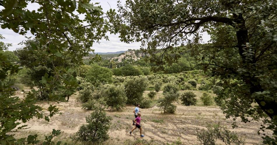
The perfect course to get into trail running, alternating between trails and small roads.Go to the route
public transportation
TransCove bus, line N
road access
By car, from Carpentras, via the D39
To note
Make sure you bring water with you.
The first half of the walk is shaded, the second half in the sun.
The first half of the walk is shaded, the second half in the sun.
 If you want to report a problem on your hike (marking, maintenance, danger...), let us know on Suricate: sentinels.sportsdenature.fr
Access to the massifs
Respect the regulations preserving protected natural areas – find out about restrictions to accessing the massifs during fire risk periods, from 15 June to 15 September.
Before heading out, check the website
Respect the regulations preserving protected natural areas – find out about restrictions to accessing the massifs during fire risk periods, from 15 June to 15 September.
Before heading out, check the website
In brief
Explore the Forêt Départementale de St Didier. Perfect for trail running, the route offers beautiful views over the region and the Ventoux. A gentle route you can complete with no major difficulty.Downloads
Contact
Ventoux Provence TourismeTel : View number
E-Mail : carpentras@ventouxprovence.fr
Website : https://www.jaimecourir.fr/UniversTrail.aspx?univertrail=vaucluse
Guided hikes
This page was produced with the help of theOffice de tourisme Ventoux Provence Tourisme