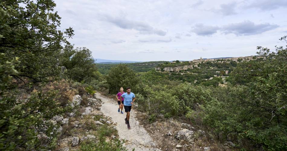
Le Beaucet
TV07 - Between Venasque and Le Beaucet
Route
Loop
Difficulty
Intermediate
Duration
2h
Distance
15km
Positive elevation gain
0 meters
Negative elevation gain
0 meters
Altitude
Min. 0 meters
Max. 0 meters
Departure / Arrival
Parking - Beaucet / Parking - Beaucet
Parking
profil altimétrique
Downloads
Traces GPX
1 / 1
Tourist service in Le Beaucet :
Route designed specifically for trail running. Discover the Devil's Valley and the priory of Notre Dame de Vie.Go to the route
public transportation
TransCove bus, line N
road access
By car, from Carpentras via the D39
To note
Make sure you bring water with you.
A bit steep at the start, then easier as you go on.
A bit steep at the start, then easier as you go on.
 If you want to report a problem on your hike (marking, maintenance, danger...), let us know on Suricate: sentinels.sportsdenature.fr
Access to the massifs
Respect the regulations preserving protected natural areas – find out about restrictions to accessing the massifs during fire risk periods, from 15 June to 15 September.
Before heading out, check the website
Respect the regulations preserving protected natural areas – find out about restrictions to accessing the massifs during fire risk periods, from 15 June to 15 September.
Before heading out, check the website
In brief
The ground is very easy to run on without any particular difficulty.A magnificent calade during the first kilometreYou will pass the famous Venasque climbing routesTake care at kilometre 6 with an 800m crossing of the RD28.Downloads
Contact
Ventoux Provence TourismeTel : View number
E-Mail : cdpal@vaucluse.fr
Website : https://www.jaimecourir.fr/UniversTrail.aspx?univertrail=vaucluse
Guided hikes
This page was produced with the help of theOffice de tourisme Ventoux Provence Tourisme